Michigan Just Quietly Killed an Iconic State Highway
For decades the roads of downtown Lansing have formed a ring around the state capitol and the Michigan Department of Transportation recognized that roadway network with a specially designated highway, the Capitol Loop.
In Spring 2024, the roadway vanished. To be clear, the streets are still there, but they are no longer designated as Capitol Loop.
Capitol Loop was a 2.4 mile ring of streets that ran from I-496 north via MLK Blvd or Larch/Cedar Streets to Ottawa and Allegan Streets, the east-west roadways that flank the state capitol.
READ MORE: The Mackinac Bridge Should Not be Part of America's Interstate Highway System - Here's Why
Those two streets Ottawa and Allegan are one-way roads and that is what eventually spelled the demise of Capitol Loop. The City of Lansing desired to make both of those streets two-way and to do that, they needed to be under local, not state, jurisdiction. MDOT agreed and transferred control of the roadways to the City of Lansing at the end of March 2024.
Since those roadways are no longer MDOT highways, that meant the designation that ran along them, Capitol Loop needed to go away as well.
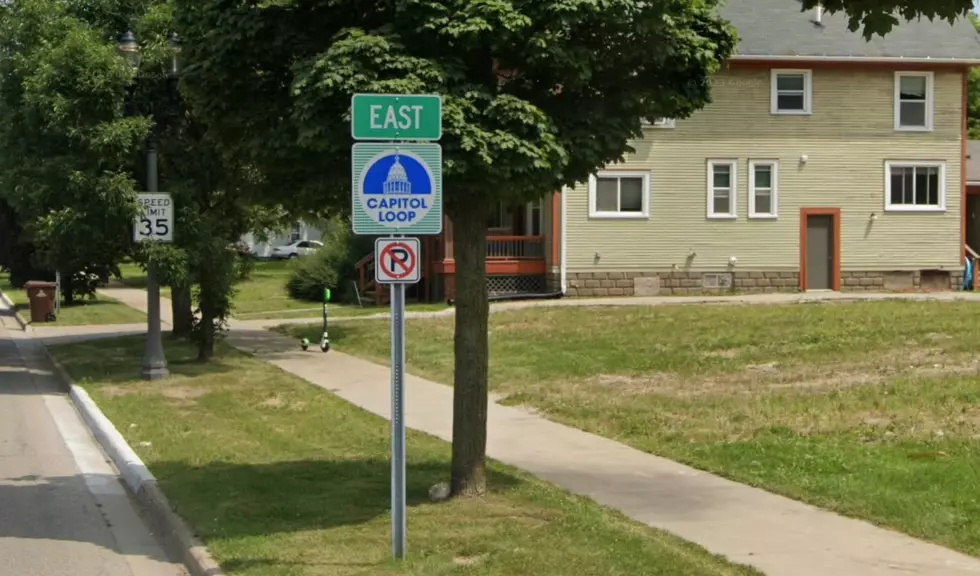
Capitol Loop was unique among the state's highway system in that it was displayed by only a name and a graphic on the sign rather than a number. Although internally, MDOT did use the name Connector 496.
Capitol Loop was created in 1986 as part of an effort to revitalize the area around the state's capitol as well as the nearby state library and history museum. MichiganHighways.org the most robust site about the state's highways system has a deep dive history of the roadway.
See the Must-Drive Roads in Every State
Gallery Credit: Sarah Jones
More From Mix 95.7

