Watch Out for Icy Roads – Winter Storm Warning in Effect for West Michigan
A significant storm is expected to sweep through West Michigan this week.

The National Weather Service has issued Winter Storm Warnings and Ice Storm Warnings for nearly all of lower Michigan 10a.m. Wednesday Feb. 22 to 4a.m. Thursday Feb. 23.
Some snow flurries are possible this afternoon, and according to Wood TV 8, overnight one two inches of accumulating snow are possible north of Grand Rapids, which could result in slippery roads Wednesday morning.
Wednesday into Thursday, heavy mixed precipitation is predicted, with total snow accumulations of 1 to 3 inches and ice accumulations up to a quarter of an inch. Winds could gust as high as 40 mph.
Here is a detailed breakdown from the National Weather Service for the counties of Mason, Lake, Osceola, Clare, Oceana, Newaygo, Mecosta, Isabella, Muskegon, Montcalm, Gratiot, Ottawa, Kent, Ionia, and Clinton Counties:
- Wednesday: A chance of rain, snow, freezing rain, and sleet before 1pm, then rain or freezing rain between 1pm and 4pm, then freezing rain, possibly mixed with sleet after 4pm. High near 32. Breezy, with an east wind 17 to 23 mph, with gusts as high as 36 mph. Chance of precipitation is 100%. New ice accumulation of less than a 0.1 of an inch possible. New snow and sleet accumulation of around an inch possible.
- Wednesday Night: Freezing rain and sleet, becoming all freezing rain after 10pm. The sleet could be heavy at times. Low around 26. Windy, with an east northeast wind 25 to 31 mph, with gusts as high as 40 mph. Chance of precipitation is 100%. New sleet accumulation of around 2 inches.
- Thursday: Freezing rain before 1pm, then a chance of rain and snow showers between 1pm and 4pm, then a chance of snow showers after 4pm. High near 40. Breezy, with an east wind 22 to 28 mph becoming west southwest in the afternoon. Winds could gust as high as 41 mph. Chance of precipitation is 80%. New snow accumulation of less than a half inch possible.
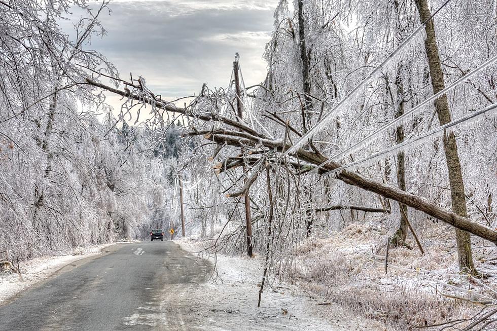
Power outages and tree damage are likely due to ice. The National Weather Service says to watch out for hazardous road conditions, as travel could become nearly impossible.
KEEP READING: Get answers to 51 of the most frequently asked weather questions...
More From Mix 95.7
