Discover Isle Phelipeaux, Michigan’s Phantom Island of Lake Superior
If you went looking for Isle Phelipeaux in Lake Superior on a map today, you won't find it. However the phantom island was once thought to exist near Isle Royale.
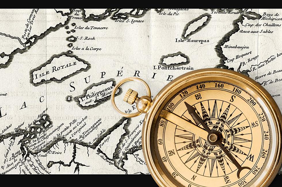
The map above was produced in 1744 and titled Map of the Lakes of Canada - you can see the entire map here in the oustanding map collection housed at Michigan State University. It's also seen here from the Clark Historic Library at Central Michigan.
The mistake island is located between Isle Royale and the Keweenaw Peninsula. Incredibly, even though the island doesn't exist, it was considered part of the border that defined the United States and Canada in the 1783 Treaty of Paris.
Isle Phelipeaux has also been called Isle Minong. That name, Minong, lives on as a term describing a ridge of high land on Isle Royale and a location in Wisconsin.
It wasn't until 1820 when the border between the United States and Canada was being further surveyed that it was discovered that Isle Phelipeaux wasn't really there.
Incredibly, Phelipeaux isn't the only misplaced island in Lake Superior, there is also a legend of Copper Island a land that was said to once exist somewhere in the lake.
That's a lot of history for a patch of land that doesn't exist.
The 1744 map showing the phantom island is prized among collectors and pops up on map collector websites on occasion.
Sail the width and breadth of the massive Lake Superior and you'll never find Isle Phelipeaux, but you can find many hidden gems traveling around America.
LOOK: 25 must-visit hidden gems from across the US
Gallery Credit: Abby Monteil
More From Mix 95.7


![I’m Tired Of People Thinking I’m Racist Because I Grew Up In Howell, Michigan [OPINION]](http://townsquare.media/site/44/files/2023/01/attachment-The-City-of-Howell-Michigan-Government.jpg?w=980&q=75)