Winter Not Done With West Michigan Yet – Winter Weather Advisory Tuesday Night
We might be done with winter, but it's not done with us.

I know, I know, it's Michigan - ice and snow happen this late in March, into April, and sometimes (let's hope not this year) even into May. (By the way, have you ever heard of the Snowstorm of May 9, 1923? Flint got 12 inches and Grand Rapids got 5.5 inches of snow, according to MLive.)
The National Weather Service has issued a Winter Weather Advisory in West Michigan tonight (Tuesday, March 29) starting at 8p.m. through 10a.m. on Wednesday. The counties of Muskegon, Ottawa, Kent, Ionia, and Barry and included in the advisory.
The high temperature in Grand Rapids today is 46 degrees. Tonight, the low is 32 degrees.
A Winter Weather Advisory has also been issued for the counties of Mason, Lake, Osceola, Clare, Oceana, Newaygo, Mecosta, Isabella, Montcalm, Gratiot, and Clinton 10p.m. Tuesday through noon on Wednesday.
According to Fox 17, counties not under advisory will likely only see rain and maybe a thundershower or two.
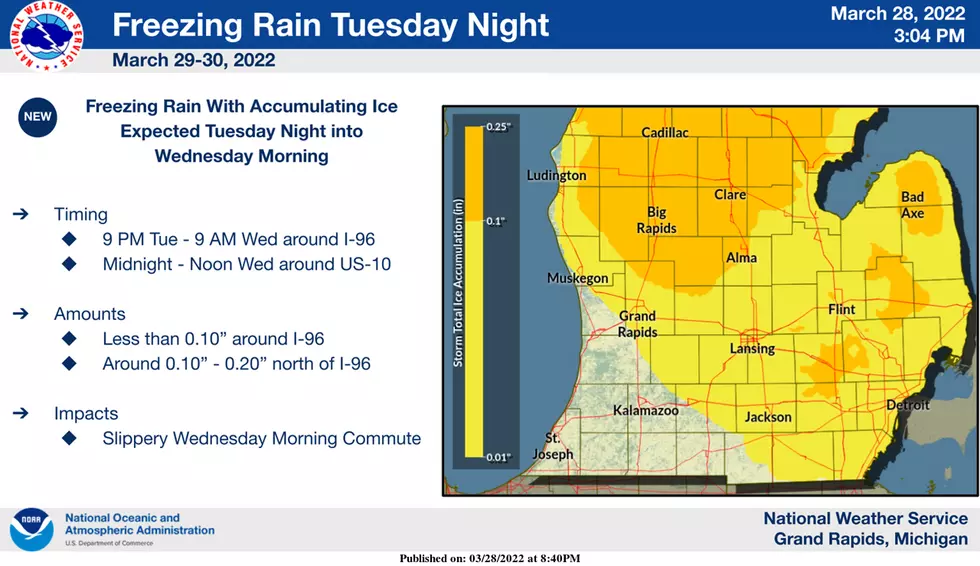
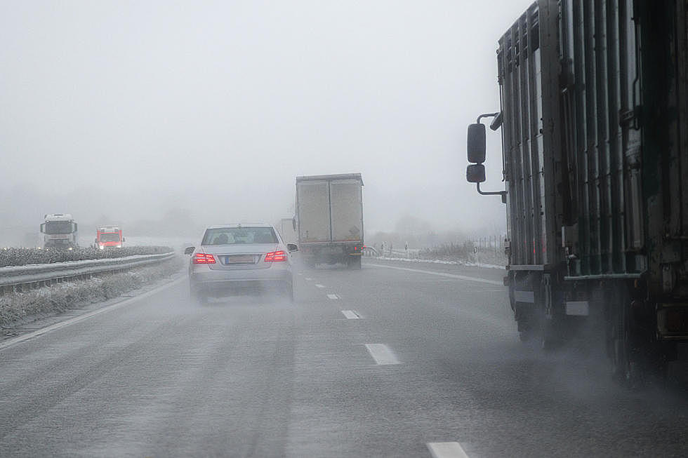
Mixed precipitation including freezing rain and ice pellets are expected. Total snow accumulations of up to one inch and ice accumulations of around one tenth of an inch are possible. By noon on Wednesday, the wintry mix is expected to turn to rain.
Drivers should plan on slippery road conditions and hazardous conditions that may impact the Wednesday morning commute.
Looking ahead, temperatures are expected to warm Wednesday, reaching a high around 60 degrees. More rain and thundershowers are likely. Thursday will be cooler, with a high of 46. Rain may transition into snow later in the day Thursday, according to Fox 17.
KEEP READING: Get answers to 51 of the most frequently asked weather questions...
More From Mix 95.7